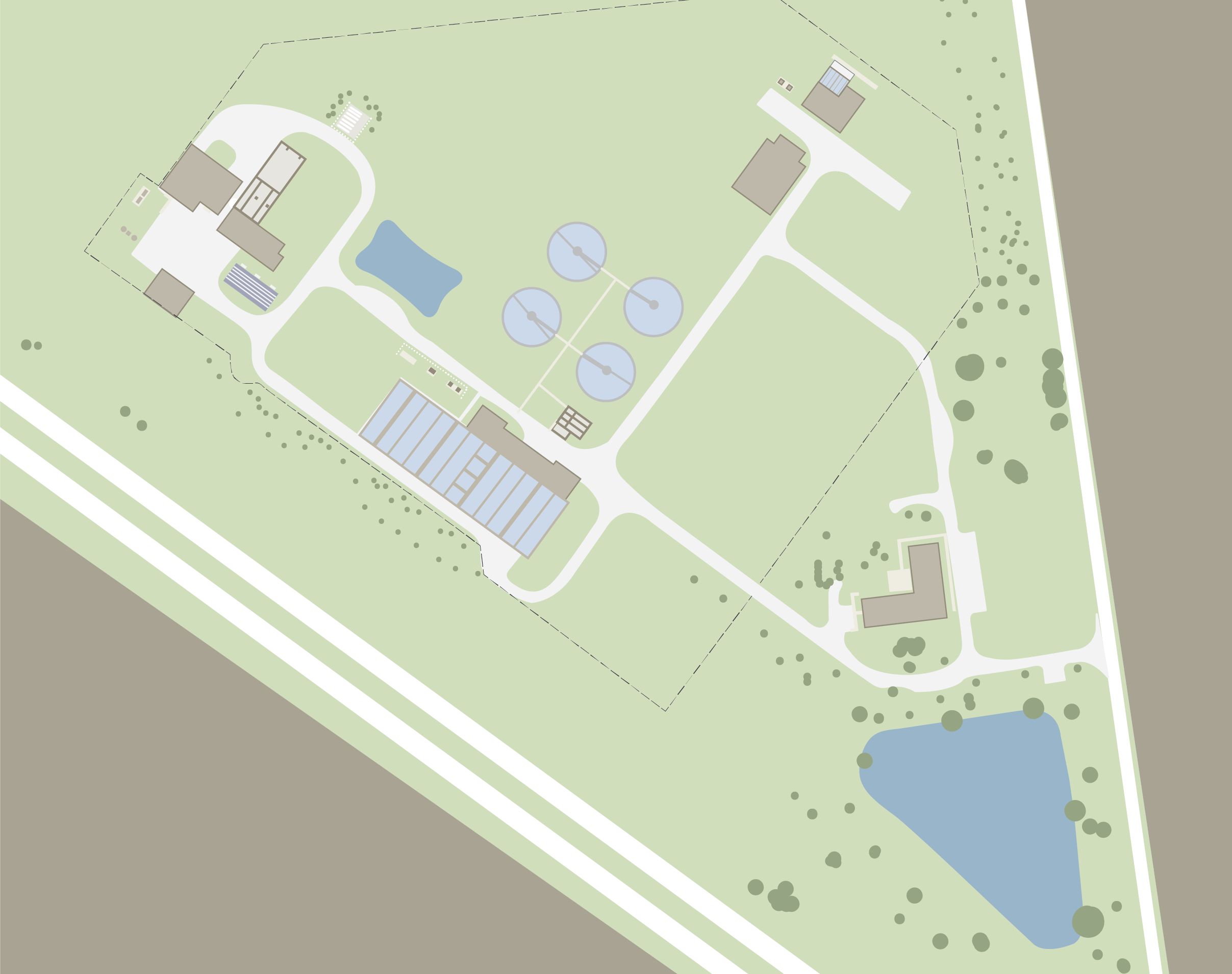
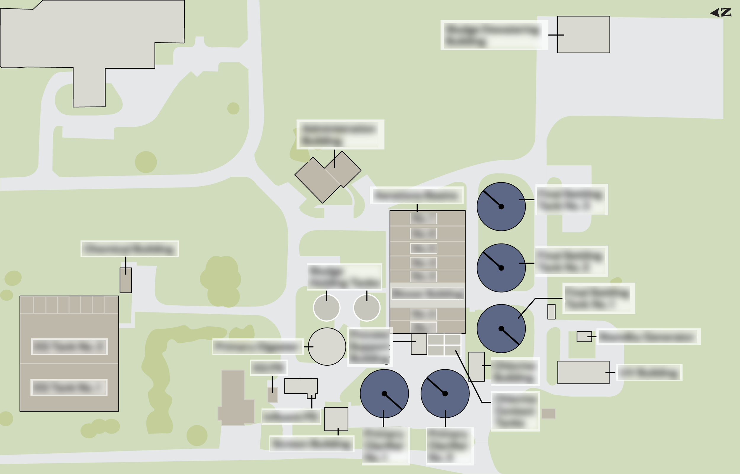
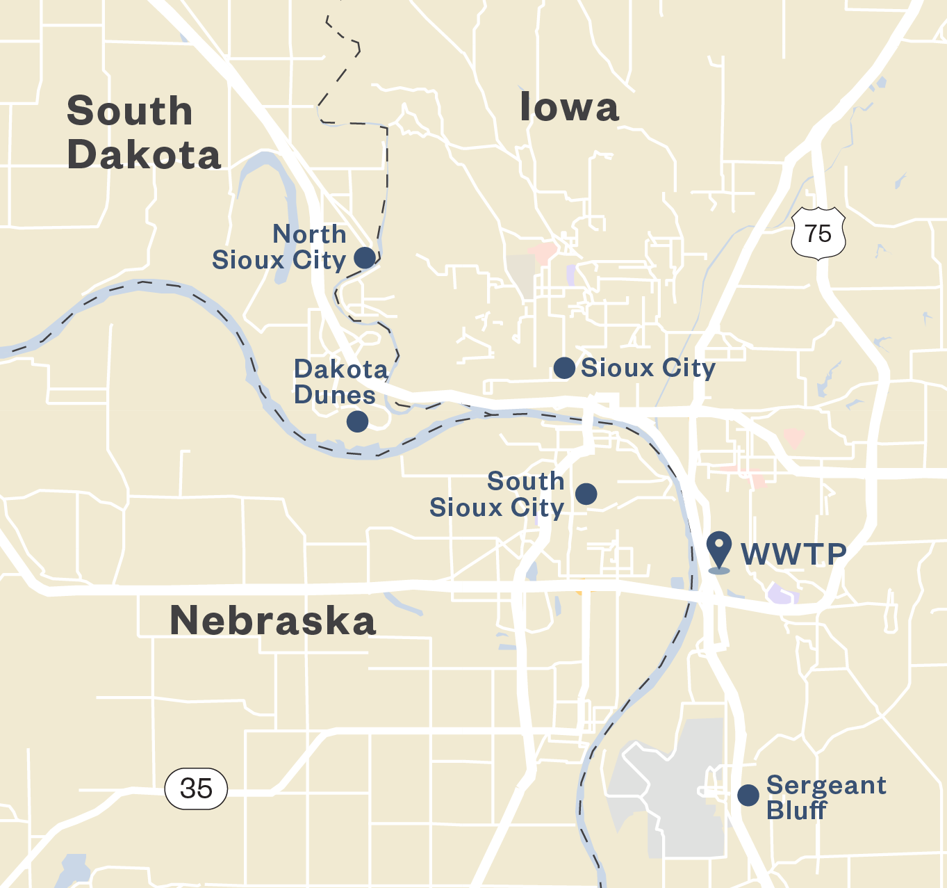
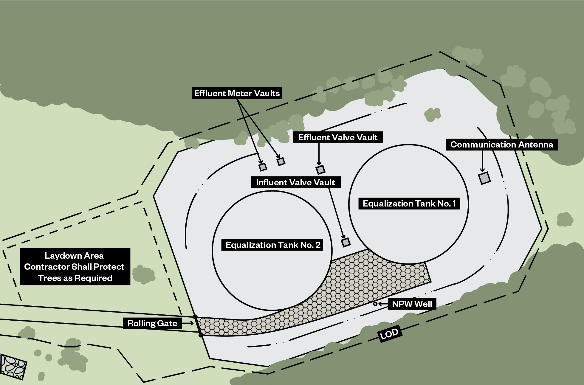
Hazen Aerial Maps
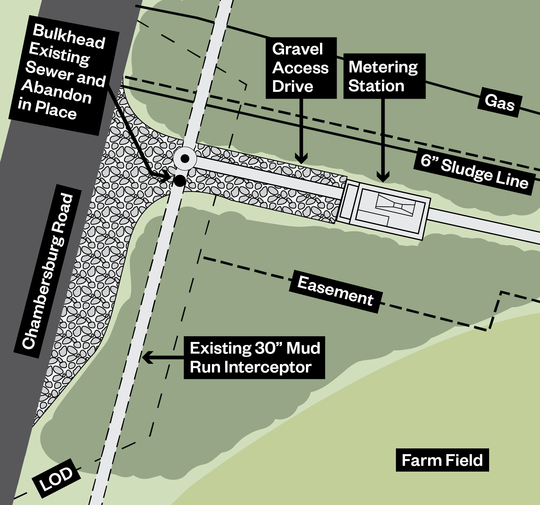
These aerials illustrate Hazen client facilities and site layouts. They are often marked up by engineers to show areas for improvement and to show familiarity with the client’s sites and for areas of improvement. Or maps of the client’s cities can show the engineers understand the context of the facilities and the impact on the surrounding area.